After several days of unusually warm weather across Jammu and Kashmir, a significant shift in weather conditions is expected as rain and snowfall are likely to affect several parts of the Union Territory. The Meteorological Centre in Srinagar has issued an advisory predicting cloudy skies, rainfall in plains, and snowfall in the higher reaches of Kashmir. The development marks a noticeable change from the persistent warm conditions that had dominated the region in recent weeks, with temperatures remaining far above seasonal averages.
The upcoming weather system is expected to bring relief from the unusually high temperatures that have been recorded across Jammu and Kashmir. Meteorological officials have noted that the region has experienced a prolonged warm spell during the late winter period, with temperature readings significantly higher than normal seasonal levels. In some areas, the difference between actual temperatures and the long-term average had widened to nearly ten degrees Celsius above normal, raising concerns among residents, farmers, and weather observers.
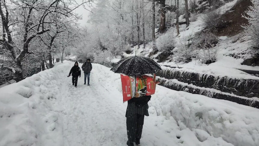
Cloudy conditions are expected to prevail across the Union Territory as the weather system moves through the region. Rainfall is likely in many parts of Jammu and Kashmir, while moderate snowfall is expected in higher altitude areas of north and central Kashmir. The return of precipitation may help stabilise temperature patterns and restore more typical seasonal conditions.
However, the weather department has also warned that the incoming snowfall could disrupt travel in mountainous areas. High-altitude roads and mountain passes that connect remote regions are particularly vulnerable to disruptions caused by fresh snow accumulation. Travellers and local authorities have been advised to remain alert to changing conditions and possible traffic restrictions on these routes.
The weather shift highlights the dynamic nature of climate patterns in Himalayan regions such as Jammu and Kashmir, where temperature variations and precipitation changes can occur rapidly due to atmospheric systems moving across the mountains.
Unusual Heatwave Conditions Across the Region
The recent warm spell in Jammu and Kashmir has been notable for its intensity and duration. Over the past several weeks, temperatures in many locations have remained significantly higher than the seasonal average, creating conditions that resembled early summer rather than late winter.
Meteorological observations showed that the gap between normal and actual temperatures had widened considerably in several parts of the region. Until last week, some areas recorded temperatures nearly ten degrees Celsius above normal levels, an unusually large difference for this time of year.
Although occasional snowfall occurred in higher altitude areas, the overall pattern of warmth continued across much of the Union Territory. The persistence of these conditions raised concerns about potential impacts on agriculture, water resources, and seasonal weather patterns.
With the official arrival of the summer season approaching, the temperature gap between normal and actual readings has begun to narrow slightly. However, the difference remains noticeable, indicating that the region has experienced a significantly warmer period than usual.
Recent temperature readings illustrate how unusual the conditions have been. In Jammu city, the maximum temperature reached 31.2 degrees Celsius, which was about 5.8 degrees above the normal seasonal value. The minimum temperature in the city settled at 19.1 degrees Celsius, reflecting the continuation of relatively warm nights as well.
In Katra, the base town for pilgrims visiting the Mata Vaishno Devi shrine, the difference between actual and normal temperatures was even more pronounced. The town recorded a maximum temperature of 30.4 degrees Celsius, which was approximately 9.3 degrees above the seasonal average. The minimum temperature in Katra was recorded at 17.7 degrees Celsius.
Conditions in the Kashmir Valley were comparatively cooler but still reflected unusual warmth for the season. Srinagar recorded a maximum temperature of 17.6 degrees Celsius and a minimum temperature of 10.2 degrees Celsius. Although these readings appear moderate compared to those in Jammu, they remain higher than the typical temperatures expected during this period.
Hill destinations, which are known for their colder climates during winter months, recorded lower temperatures but still displayed signs of warming trends. Gulmarg, a popular winter tourism destination known for skiing, reported a maximum temperature of 8.4 degrees Celsius and a minimum of 4.4 degrees Celsius. Banihal, another mountainous location, recorded a maximum temperature of 23.1 degrees Celsius and a minimum of 13.2 degrees Celsius.
These temperature patterns demonstrate the unusual warmth that has persisted across different elevations in the region, prompting meteorological authorities to closely monitor weather developments.
Forecast: Rain in Plains, Snowfall in Higher Reaches
The latest forecast from the Meteorological Department indicates that weather conditions across Jammu and Kashmir are expected to remain unsettled in the coming days. The arrival of a new weather system is likely to bring widespread cloud cover along with precipitation in several parts of the region.
Rainfall is expected to occur in many areas across the plains and lower elevations of the Union Territory. Meteorologists have predicted light to moderate rainfall that may help cool temperatures and provide some relief from the recent warm conditions.
At the same time, higher altitude regions of north and central Kashmir are likely to receive moderate snowfall. Mountainous districts that typically experience winter snowfall may once again see snow accumulation as the weather system moves across the Himalayan terrain.
Authorities have warned that fresh snowfall could lead to disruptions on mountain roads and high-altitude passes. These routes are often used by local residents, transport vehicles, and tourists travelling to scenic destinations. Snow accumulation may temporarily block roads or slow down traffic, particularly in areas where snow-clearing operations are required.
The weather department has also issued an advisory for farmers in the region. Agricultural communities have been urged to suspend farming activities and avoid spraying operations for the next two days due to the expected rainfall and strong winds. Such precautions are recommended to prevent damage to crops and ensure safety during unstable weather conditions.
Thunderstorms accompanied by gusty winds are also possible in certain areas. Forecasts suggest that wind speeds could reach between 30 and 40 kilometres per hour during periods of storm activity. Strong winds combined with rain or snowfall may affect visibility and transportation, making it important for residents to remain cautious.
Following the current spell of rain and snowfall, meteorologists expect a short dry period to develop across the region. A relatively stable weather phase is predicted between March 12 and March 14, during which conditions may become clearer with limited precipitation.
However, the break in precipitation may be temporary. Weather experts have indicated that another weather system could approach the region shortly after this dry spell. Forecasts suggest that fresh cloud cover and light precipitation could occur again around March 15 and 16, particularly during the night of March 15.
Beyond that, weather conditions may remain somewhat unsettled through the third week of March. Light rain and snowfall could occur intermittently at several locations across Jammu and Kashmir between March 17 and March 20.
Such patterns are typical for Himalayan weather systems during transitional seasons, when atmospheric disturbances frequently move across the region, bringing alternating phases of precipitation and clear weather.