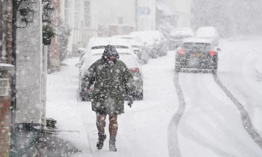
The United Kingdom is bracing for three days of significant snowfall and plummeting temperatures, with a Met Office yellow warning issued for snow across England, Wales, and parts of Scotland this weekend. The warning highlights the potential for rural communities to be cut off, school closures, power outages, and severe travel disruptions. The icy conditions are expected to persist into Monday, exacerbating the wintry weather that has already battered parts of the country.
The snow warning begins at noon on Saturday and extends until 9:00 GMT on Monday, covering most regions of England except the South West, along with Wales and southern Scotland. Forecasters predict around 5 centimeters of snow in areas like the Midlands, Wales, and northern England, with up to 20-30 centimeters on higher ground, including the Pennines and parts of Wales. Strong winds may lead to snow drifting, adding to the hazardous conditions. Scotland and Northern Ireland are also expected to experience disruptive snowfall, while southern England may see snow turn back into rain as milder air temporarily moves in.
Temperatures are predicted to start falling overnight on Wednesday, with icy conditions anticipated in parts of the UK on Thursday morning and snowfall likely in Scotland. Arctic air sweeping across the country will create bitterly cold conditions by Thursday, accompanied by a mix of sunny spells and wintry showers. The cold snap sets the stage for widespread snowfall over the weekend.
Ben Rich, lead presenter for BBC Weather, cautioned that forecasting snow can be challenging due to the variability in temperature and the track of low-pressure systems, which can determine whether an area experiences snow, sleet, or rain. He noted that forecasts could be modified closer to the weekend as confidence in the underlying data improves.
This impending snowstorm follows a period of heavy rain and strong winds that caused extensive flooding across the north-west of England. Greater Manchester faced significant disruptions on New Year’s Day, with flooding affecting areas such as Bolton, Didsbury, South Manchester, Harpurhey, Stalybridge, Stockport, and Wigan. In Cheshire, the collapse of the Bridgewater Canal’s banks led to road closures and property evacuations in Little Bollington. Over the past 24 hours, north-west England has seen widespread rainfall totaling around 90 millimeters, with over 100 millimeters recorded on some hills in north Wales and Cumbria.
Even London faced challenges as its New Year’s Day parade experienced a brief delay due to high winds and heavy rain. The incoming snowstorm is expected to bring further disruption, intensifying the already challenging start to 2025 for many across the UK.